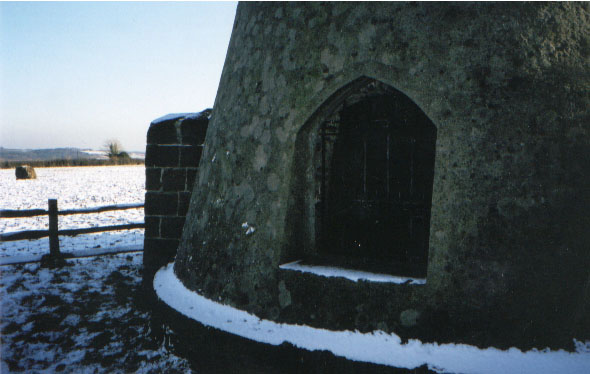
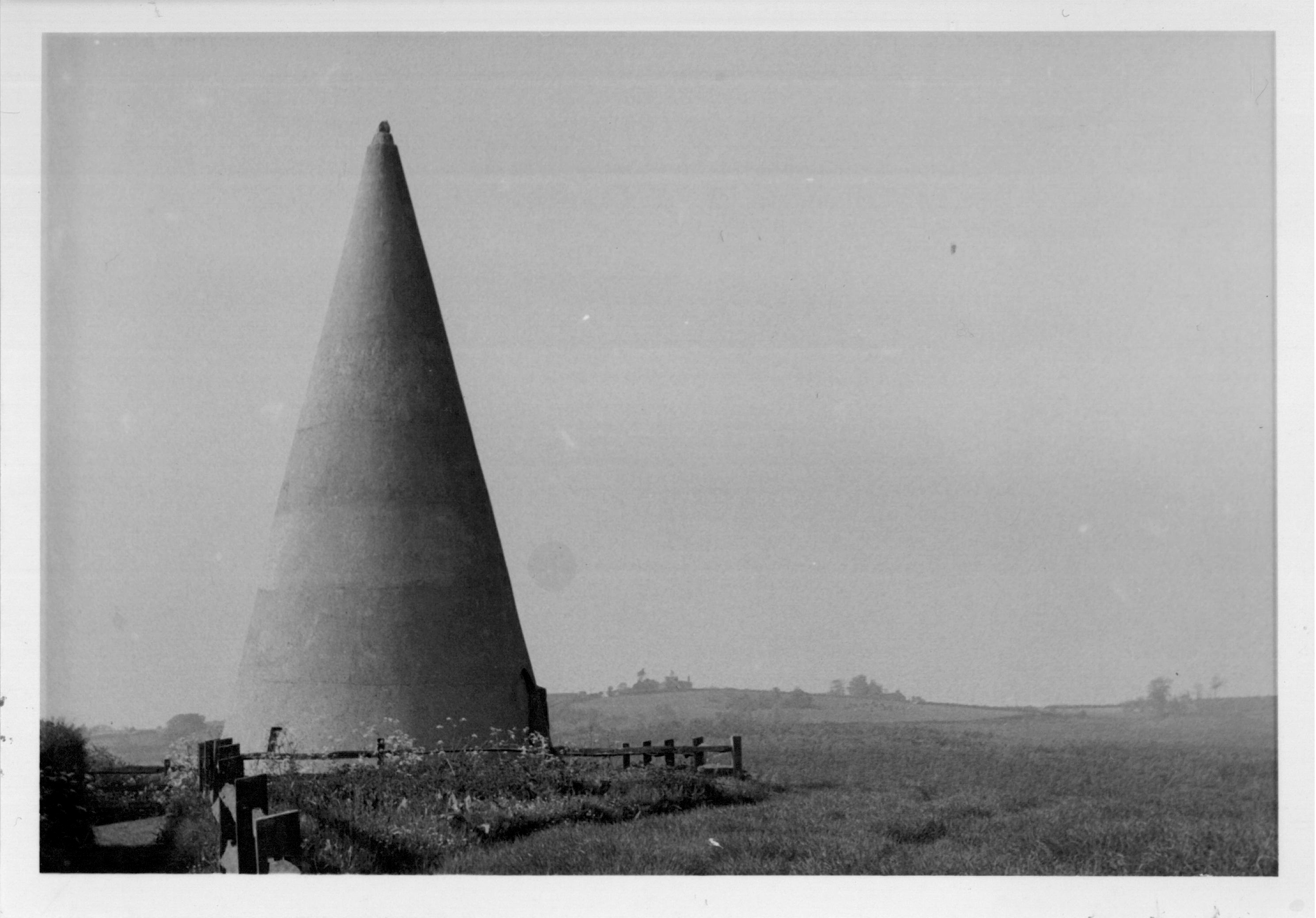
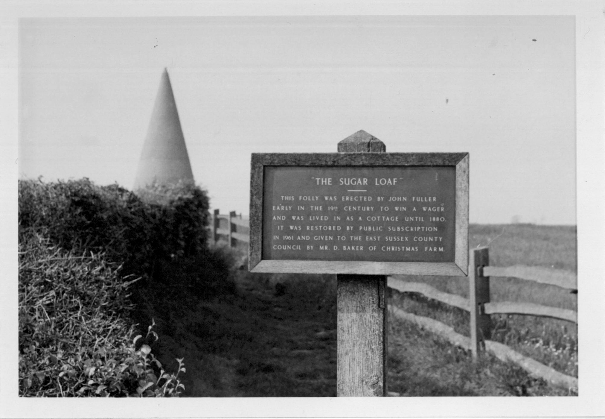
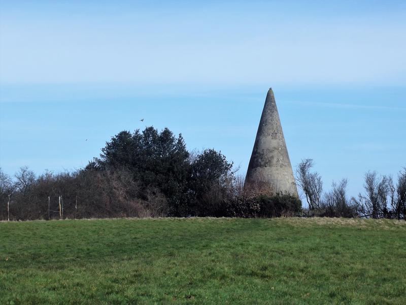
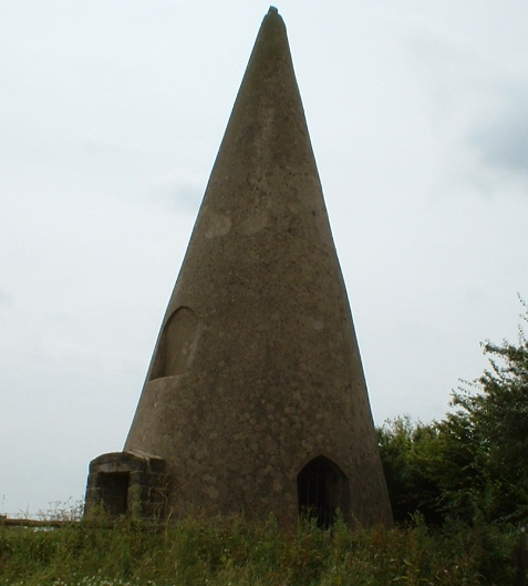
Also known as Fuller's Point, this folly stands 35 feet 
(10.7 m ) tall in a meadow just off the Battle-Heathfield road B2096, near Wood's Corner in East Sussex (Sometimes spelled Sugarloaf).

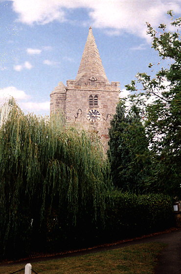
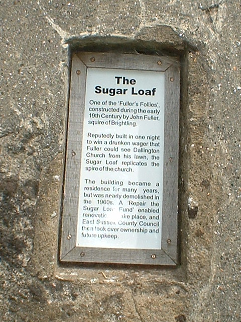
Legend has it John "Mad Jack" Fuller made a wager that he could see the spire of St Giles, Dallington from his house, Rose Hill in Brightling. When he Realized that this was not true he had workmen hurriedly erect this folly in order to win the bet. There are many versions of this story which adds to its mystique. 

It is thought to have been built in the early 1820s and gets its name from the conical loaf form that sugar was sold in at that time.
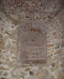
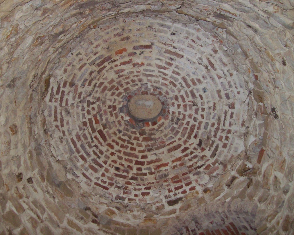
It's hard to believe that the Sugar Loaf Folly was actually used as a two storey dwelling.  Considering that it is only 15 feet (4.57 m) in diameter it's hard to imagine a family living there. 

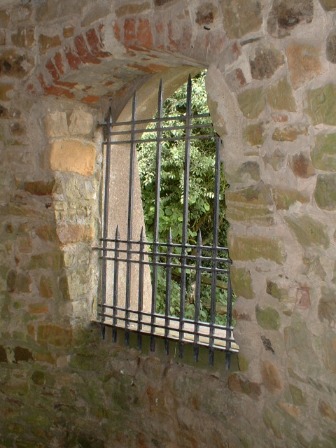
"It is thought that Simeon Crouch and his family may have lived in the Sugar Loaf in the late 1870s, as family members have been told that one of his daughters, Mabel, was born there in 1879. Relatives of the Lulham family are believed to be the last people to live in the Sugar Loaf.  The stone building had two storeys, with windows on each floor. There was a ladder between the two floors and there was also a lean-to kitchen."

Dallingon: Six miles from Everywhere, the History of a Sussex Village,
by  Karen Bryant-Mole
The Sugar Loaf or Fuller's Point
© 2000 Annette Lloyd Thomas
St Giles Church,Dallington
© 1995 Hans-Georg Stump
© 2003 Annette Lloyd Thomas
Plaque on the Sugar Loaf
Click here for enlarged view
HOME | FULLER | FOLLIES | FAMILYFRIENDS | FAITH  | FEATURES
© 2003 Annette Lloyd Thomas
© 2006 Annette Lloyd Thomas
During the Second World War, the Sugar Loaf became used as an anti-invasion machine gun post.

It fell into disrepair during the 1950s and when Dennis Baker bought Christmas Farm, on which the Sugar Loaf stands, he transferred it to the East Sussex County Council in 1961.
Loaves of sugar
The only window not bricked up
Snow on the base of the Sugarloaf
This plaque has since been removed
© 2011 Richard Groves 
The Sugarloaf is a brick structure covered with concrete
© 2011 Richard Groves 
Bricked up first floor window.
© 2011 Richard Groves 
Beehive shaped ceiling 
inside the Sugarloaf
Description: The Sugarloaf

Grade: II*
Date Listed: 3 August 1961
English Heritage Building ID: 408851

OS Grid Reference: TQ6692119550
OS Grid Coordinates: 566921, 119550
Latitude/Longitude: 50.9512, 0.3750
Location: B2096, Dallington, East Sussex TN21 9LJ


Locality: Dallington
Local Authority: Rother District Council
County: East Sussex, England

Source: British Listed Buildings

THE SUGAR LOAF

THIS FOLLY WAS ERECTED BY JOHN FULLER
EARLY IN THE 19TH CENTURY TO WIN A WAGER
AND WAS LIVED IN AS A COTTAGE UNTIL 1880.
IT WAS RESTORED BY PUBLIC SUBSCRIPTION
IN 1961 AND GIVEN TO THE EAST SUSSEX COUNTY
COUNCIL BY MR. D. BAKER OF CHRISTMAS FARM
© 1962 Bill Fuller
With Kind Permission of Simon Fuller
© 1962 Bill Fuller
With Kind Permission of Simon Fuller
© 2018 Annette Lloyd Thomas
Brightling Needle
Observatory
Temple
Pyramid
Sugar Loaf
Other
Tower
Summerhouse
John 'Mad Jack' Fuller
The Sugar Loaf Folly
Fuller Family of Sussex  GENEALOGY PAGES
On the Trail of Mad Jack Fuller  BLOG
MJFWalk.pdf
MJFWalk.pdf
DOWNLOAD pdf VERSION HERE